El Niño: The Pacific Ocean Phenomenon That Can Change Weather Around the World
Posted 9 hours ago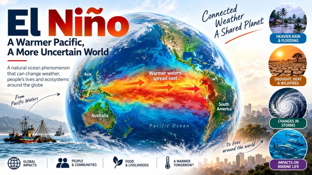
39/2026
El Niño may sound like a distant oceanic event, but its effects can reach nearly every corner of the planet. It is a natural climate phenomenon that begins with an unusual warming of the tropical Pacific’s surface waters. The 2026 event is particularly remarkable: scientists expect it to become an exceptionally strong, possibly record-breaking “Super El Niño.”
What exactly is El Niño?
Under normal conditions, strong trade winds push warm surface water westward across the tropical Pacific toward Indonesia and Australia. Meanwhile, cold, nutrient-rich water rises from deeper waters near the coasts of Peru and Ecuador, supporting large fish populations.
During El Niño, these trade winds weaken. Warm water that normally stays in the western Pacific spreads eastward. As a result, the ocean releases enormous amounts of heat into the atmosphere, disrupting normal patterns of winds, rainfall, and temperature around the world.
Why is the current El Niño so unusual?
The 2026 event has intensified rapidly. NOAA reports that sea-surface temperatures in parts of the eastern tropical Pacific are more than 3°C above average. In some areas, unusually warm water beneath the surface exceeds 10°C above normal. There is now more than a 90% chance of a very strong El Niño during the Northern Hemisphere autumn and winter.
Some scientists believe it could become the strongest El Niño in at least 150 years.
What does it mean for ordinary people?
The important thing to understand is that El Niño does not make the entire world warmer or wetter in the same way. Instead, it rearranges weather patterns.
Some regions may experience heavy rain, flooding, and storms, while others face drought, heat, and wildfires. For example, parts of South America can receive exceptionally heavy rainfall, while Indonesia and Australia may become unusually dry. In the United States, El Niño can alter winter temperatures and precipitation, suppress Atlantic hurricane activity, and increase storminess in parts of the Pacific.
The consequences can extend beyond weather. Warmer Pacific waters disrupt marine ecosystems and fisheries. In Peru, for instance, anchovies have moved into deeper waters, severely affecting fisheries. At the same time, warm-water species such as tuna have become more abundant in areas where they are normally less common.
Could it make 2027 exceptionally hot?
This is one of the biggest concerns. El Niño naturally transfers enormous amounts of heat from the ocean to the atmosphere. When that extra heat is added to the warming already caused by human activities, global temperatures can rise sharply. Scientists therefore expect 2027 to challenge or even break global temperature records if the event develops as currently projected.
El Niño is, however, a natural phenomenon, not something created by climate change. The concern is that human-caused global warming is raising the baseline, potentially making the consequences of an unusually strong El Niño more severe.
A global reminder
El Niño demonstrates how closely connected Earth's systems are. A change in ocean temperature thousands of kilometers away can influence rainfall, agriculture, fisheries, wildfires, storms, food prices, and temperatures worldwide.
The current super El Niño is therefore more than an unusual Pacific Ocean event. It reminds us that the ocean and atmosphere function as a single, interconnected system and that a disturbance in one part of the planet can have consequences far beyond its point of origin.