59/25 FloodCastBench: A New Frontier in Flood Forecasting, Could It Have Saved Pakistan in 2025?
Posted 9 months ago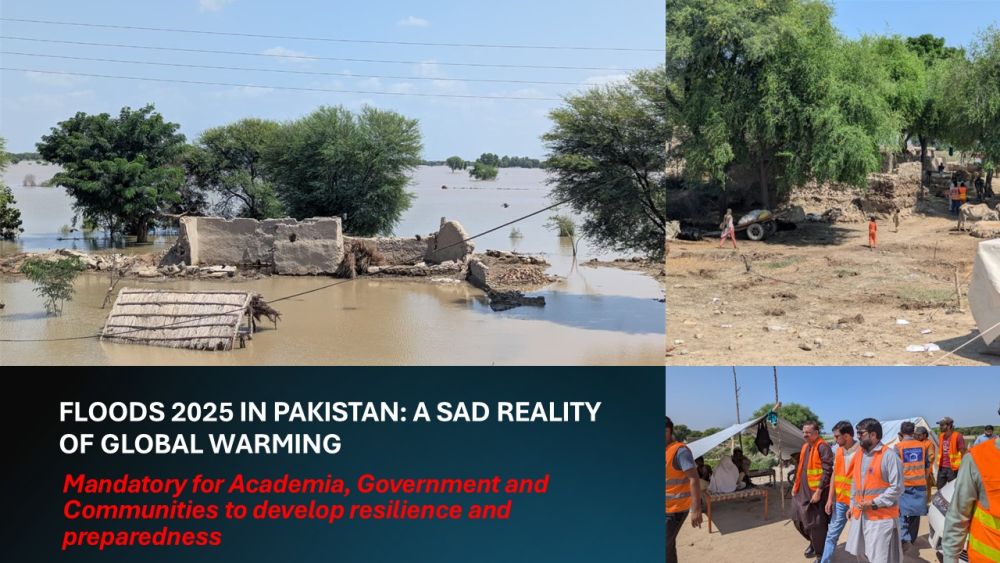
Photographs: With courtesy of Mr. Murtaza Noor
Executive Summary & Disclaimer
This article highlights the potential of advanced datasets such as FloodCastBench to strengthen flood forecasting, emergency preparedness, and recovery planning. This article is based on the scientific publication "FloodCastBench: A Large-Scale Dataset and Foundation Models for Flood Modeling and Forecasting"
What is FloodCastBench?
FloodCastBench is a large-scale dataset and associated benchmark models published in Scientific Data. It assists in flood modeling and forecasting using machine learning. It has been developed by using major global flood events, including the Pakistan floods of 2022, the UK (2015), Australia (2022), and Mozambique (2019).
Salient features of the FloodCastBench are:
- It includes dynamic flood processes, not just event footprints: water depth, inundation extents, and evolution over time.
- High resolution: nominal spatial resolution of 30 m and temporal resolution every 300 seconds (5 minutes).
- For calibration and validation, inputs include topography (DEM), land use and cover, rainfall time series (from satellite data), and flood measurement (SAR maps, surveyed outlines).
- It also builds benchmark ML models (U-Net, Fourier Neural Operator (FNO), and variants) for forecasting applications, including cross-regional transfer (i.e., training in one region, predicting in another).
Strengths of FloodCastBench - What It Does Well?
Dynamic, high-resolution modeling. It enables more precise forecasting by capturing flood dynamics (water depth, spread, timing) rather than just static inundation maps. For example, distinguishing shallow flooding from deep water is critical for evacuation planning.
Cross-regional transferability. Models trained on data from one flood event/region being adapted for another is powerful, especially for data-scarce areas. This makes the approach more scalable.
Open data + reproducible benchmarks. Public access to the dataset means researchers and practitioners worldwide can use, test, improve, or adapt these tools.
Temporal granularity. Five-minute temporal steps are reasonable for near-real-time forecasting. Many older systems have coarser time steps, which reduce responsiveness.
Limitations & Gaps - Where It Might Fall Short for 2025 Floods in Pakistan
However, despite its strengths, there are several reasons.
FloodCastBench, as it currently stands, would not have been sufficient to prevent or fully mitigate the impact of Pakistan’s 2025 floods. Some of these are general, others quite specific.
Lead time & forecasting vs simulation.
The dataset and models are excellent for nowcasting (describing flood dynamics once rainfall or flooding has already begun) and short-term forecasting based on immediate inputs. However, long-lead forecasts (days ahead), early warnings, and anticipatory action avoid many devastating flood impacts. For this, accurate meteorological forecasts (rainfall forecasts), catchment runoff modeling, upstream hydrology, etc., are required. FloodCastBench helps once rainfall occurs and is observed, but less so for anticipating extreme weather days ahead.
Data latency & real-time inputs.
To respond to a disaster, inputs like rainfall, measured water levels, terrain, and land-use must be current and continuously updated. Satellite rainfall data, SAR flood extent imaging, etc., often lag in time or suffer from cloud cover, revisit intervals, and processing delays. In 2025, if those data streams were not timely or granular for all affected areas, predictive power would suffer.
Resolution trade-offs in large areas.
Due to computational limitations, the dataset uses a lower spatial resolution (480m) for large-scale Pakistan flood reference (for “low-fidelity forecasts”). At such coarse resolution, many local vulnerabilities (small levees, minor channels, local slopes, barriers) are smoothed out or lost — these are often crucial in determining which villages get hit hardest.
Ground truth & validation constraints.
Some flood extents, especially in agricultural or vegetated lands, are under-detected by SAR imagery when water depths are shallow (e.g., below crop height). This causes mismatches between modeled inundation and observed flood extents. The study reports the Critical Success Index (CSI) for shallow thresholds is low, especially for the Pakistan flood when the threshold is very low (e.g.,≥ 0.01 m).
Computational & operational constraints.
Running high-resolution hydrodynamic modeling with fine spatial and temporal resolution over large areas (tens of thousands of km²) with rapid updates demands capacity: computing, data infrastructure, trained staff, and reliable satellite/sensor inputs. In many flood-vulnerable areas of Pakistan, not all this infrastructure is uniformly available.
Climate/event novelty & non-stationarity.
FloodCastBench is based partly on past events. But climate change alters rainfall intensity and patterns, possibly pushing events outside the historical envelope. Changes in land use (urbanization, deforestation, embankment construction, drainage infrastructure) alter hydrology in ways that past calibrated models may not capture perfectly.
Was It Helpful for the 2025 Pakistan Floods? Hypothetically, But Partial
Assuming the same quality of data, infrastructure, and model readiness as in FloodCastBench:
Yes, it could have improved situational awareness. Rapid estimation of flood spread and depths after heavy rain, better mapping of which districts/villages are getting inundated, etc., could help emergency services target relief, evacuation, prepositioning of supplies, etc.
No, it likely could not have prevented much damage on its own, because:
- The extreme magnitude of the 2025 floods might have overwhelmed early warning and response systems; delays or lack of compliance in evacuations also matter.
- If rainfall forecasts were poor or sudden, intense rainfall segments were not well captured, the lead time for response would be insufficient.
- Some areas may be affected by breaches in infrastructure (levees, embankments), landslides, channel blockages, things that hydrodynamic models with coarse terrain or coarse flood input can’t always forecast.
What Needs to Be in Place for Maximum Impact
To translate tools like FloodCastBench into life-saving change in Pakistan (or similar settings), several enabling pieces are essential:
- Strong meteorological and rainfall forecasting systems, including ensemble forecasts, have decent lead times.
- Real-time sensor networks: river gauges, rain gauges, soil moisture sensors, to feed into models for calibration and correction.
- High-spatial-resolution terrain and land-use maps, updated frequently, include small channels, levees, and urban drainage infrastructure.
- Computational infrastructure and human capacity, especially locally (provincial, district levels), are needed to run, interpret, and act on model outputs.
- Strong institutional and governance frameworks for early warning dissemination, public communication, evacuation planning, and investment in structural mitigation (levees, drainage, embankments).
- Community engagement: understanding, trust, and readiness among local populations to act when warnings are issued.
Verdict: Helpful, But Not Sufficient
In sum, FloodCastBench represents cutting-edge progress in flood modeling. For the floods of 2025 in Pakistan, it would have been helpful, especially in forecasting flood extent/dynamics and supporting emergency response, but not sufficient on its own to avert the scale of damage seen.
Without strong upstream forecasting, faster input data, local sensor networks, and operational readiness, even excellent models cannot prevent flood catastrophes alone. As climate change intensifies, integrating such datasets into national flood preparedness systems becomes vital, but nations must build the full ecosystem around them.
Looking Forward: Policy & Research Recommendations
- Expand datasets for South Asia, specifically Pakistan. Gather local flood events, including smaller-scale ones, to better train ML models for local hydrology, soil, and land cover peculiarities.
- Invest in data acquisition infrastructure. Add more radar/satellite sensors, frequent revisit, and local rainfall and river discharge stations.
- Operationalization. Turn research tools into tools used by agencies: i.e., user interfaces, dashboards, decision support systems that non-technical users (district officials, disaster management authorities) can use.
- Hybrid modeling. Combine physics-based hydrological/hydraulic models with ML-based forecasting to gain the benefits of both – interpretability, robustness, and speed.
- Climate resilience planning. Use model outputs to inform long-term infrastructure investment: where floodplains are widening, drainage improvements are needed, and flood defences should be strengthened.
Final Thoughts
As the floods of 2025 ravage Pakistan, the pain is a vivid reminder that knowledge, data, and modelling are essential, but they only form part of what saves lives. The rest lies in preparedness, governance, infrastructure, equity, and ensuring that scientific innovations stay in journal articles and enter the hands of communities, planners, and decision-makers. FloodCastBench is a promising arrow in the quiver. But to aim, shoot, and hit the target so that the next flood toll is far smaller, much more must be built around it.


